 Altădată
Historic building · 1928–1930
Ciclop Garage
The Ciclop Garage, on Magheru Boulevard, was built in the interwar period as a multi-story car park. The land, at the corner of C. A. Rosetti Street, belonged to the industrialist Dumitru Marinescu Bragadiru, who leased it in 1928 to the Ciclop company; the reinforced concrete building was put into service in April 1930. The ground floor housed a car repair shop and commercial spaces, while the upper levels and the basement were used for parking. In 1940 two floors of offices were added.
See the place on the old maps ›Text source: hotnews.ro · summary based on the source
Old photographs
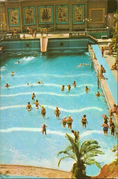
Ștrandul „Lido”
1900 · Institutul Național al Patrimoniului, colecția Andrei Ștomff · CC BY-SA 4.0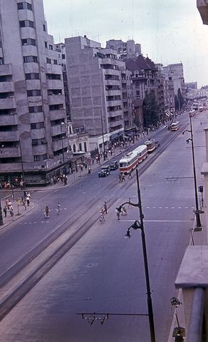
a Bulevardul General Gheorghe Magheru és folytatólag a Bulevardul Nicolae Bălcescu a Hotel Lido-ból nézve
1955 · FORTEPAN / Kocsis András · CC BY-SA 3.0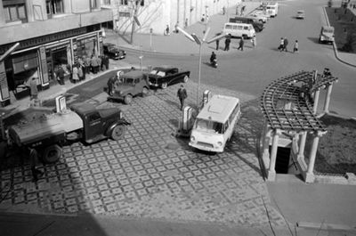
Bulevardul General Gheorghe Magheru a Hotel Lido felől a Piața Romană felé nézve, szemben kissé balra a Strada
1962 · FORTEPAN / Sattler Katalin · CC BY-SA 3.0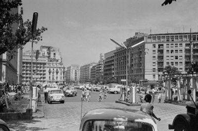
a Bulevardul General Gheorghe Magheru a Hotel Lido felől a Strada George Enescu felé nézve
1965 · FORTEPAN / Bojár Sándor · CC BY-SA 3.0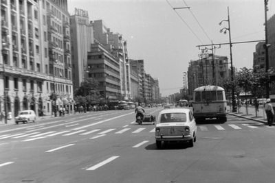
a Bulevardul General Gheorghe Magheru a Strada George Enescu felől a Hotel Lido felé nézve
1966 · FORTEPAN / Szűcs Lóránd · CC BY-SA 3.0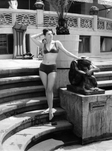
a Hotel Lido uszodája
1968 · FORTEPAN / Sütő András örökösei · CC BY-SA 3.0
On the old maps
The place appears on 44 maps and images, from 1790 to today:
- 1790 · Specht Plan
- 1791 · Ernst Plan
- 1846 · Borroczyn Plan
- 1852 · Borroczyn Plan
- 1864 · Szathmari Plan
- 1871 · Pappasoglu Plan
- 1883 · Cerkez Plan
- 1893 · Orăscu Plan
- 1896 · J. Don Plan
- 1900 · Plan of Bucharest 1900
- 1911 · Army Geographic Institute Plan
- 1914 · Socec Plan
- 1921 · Mihai Pantea Plan
- 1926 · Union Plan
- 1927 · Aerial photo 1927
- 1927 · Socec Plan
- 1928 · Industrial Plan
- 1931 · STB Plan
- 1931 · Unirea Plan
- 1934 · Wahing Plan
- 1938 · Aerial photo 1938
- 1938 · Teodorescu Plan
- 1939 · Simboteanu and Moldoveanu Plan
- ~1940 · Artillery Firing Plans
- 1943 · Aerial photo 1943
- 1966 · Satellite image 1966
- 1968 · Map of Bucharest 1968
- 1969 · Map of Bucharest 1969
- 1972 · Satellite image 1972
- 1974 · Cadastral Plan (center)
- 1976 · Satellite image 1976
- 1977 · Satellite image 1977
- 1978 · Satellite image 1978
- 1979 · Satellite image 1979
- 1980 · Satellite image 1980
- 1982 · Satellite image 1982
- 1982 · ITB Plan
- 1983 · Satellite image 1983
- 1984 · Satellite image 1984
- ~1985 · Soviet Topographic Map
- 1990 · Cadastral Plan
- 2001 · AGC Polonia Plan
- 2017 · Orthophoto 2017
- today · Current satellite
Nearby
- Boteanu Church · 120 m
- Theodor Aman Museum · 160 m
- Dimitrie Sturdza House · 170 m
- Ion Mincu House · 180 m
- Romanian Athenaeum · 180 m
- Italian Church · 210 m